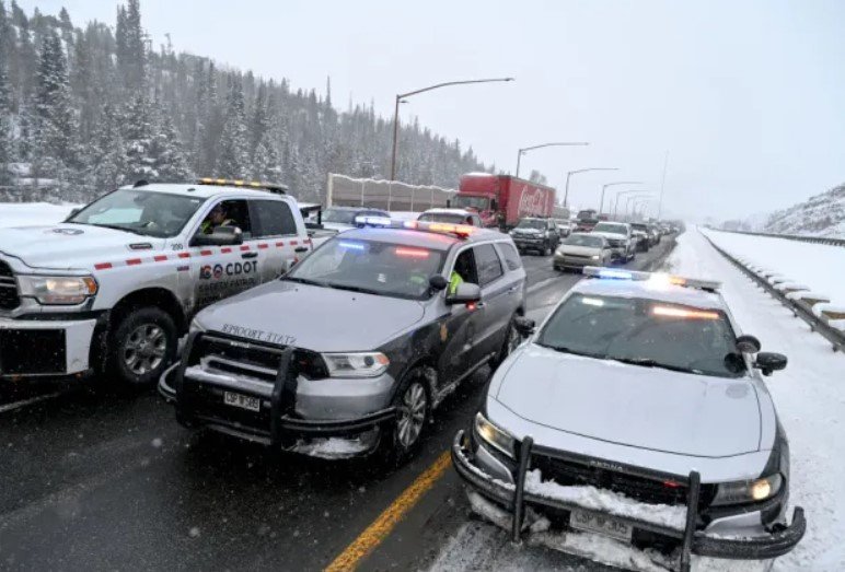
A powerful storm system that originated from the West Coast is sweeping across the country this week, affecting millions of people with snow, ice, rain, and severe weather. The storm is expected to cause travel disruptions and power outages as it moves eastward through the end of the week.

Snow and ice hit the Rockies and the Plains
The storm began to produce heavy snow and ice over the northern Rockies and the central Plains on Wednesday, where more than a half foot of snow fell near Denver. Some areas in Colorado, Nebraska, Kansas, and Oklahoma could see up to a foot of snow by Thursday, according to the National Weather Service (NWS).
The snow and ice are creating hazardous driving conditions and reducing visibility on the roads. Several accidents and road closures have been reported in the affected regions. The Colorado Department of Transportation advised drivers to avoid unnecessary travel and to prepare for winter weather.
The snow and ice are also impacting air travel, with hundreds of flights delayed or canceled at Denver International Airport and other airports in the region. Travelers are advised to check their flight status and plan ahead for possible disruptions.
Severe storms and tornadoes threaten the Gulf Coast and the Southeast
As the storm moves eastward, it will also bring the threat of severe weather to the Gulf Coast and the Southeast on Thursday and Friday. The storm will tap into warm and moist air from the Gulf of Mexico, creating favorable conditions for thunderstorms, damaging winds, hail and tornadoes.
The NWS has issued a moderate risk of severe weather for parts of Louisiana, Mississippi, Alabama and Florida on Thursday, where some storms could produce strong tornadoes. The risk area includes cities such as New Orleans, Baton Rouge, Jackson, Mobile and Tallahassee.
The severe weather threat will shift eastward on Friday, affecting parts of Georgia, South Carolina and North Carolina. The NWS has issued a slight risk of severe weather for these areas, where isolated tornadoes, damaging winds and hail are possible. The risk area includes cities such as Atlanta, Augusta, Columbia and Raleigh.
The severe storms could also produce heavy rainfall and flash flooding in some areas, especially along the Gulf Coast and the lower Mississippi Valley. The NWS has issued flash flood watches and warnings for parts of these regions, where rainfall amounts could exceed 4 inches in some locations.
Rain and snow affect the Midwest and the Northeast
The storm will also bring widespread rain and snow to the Midwest and the Northeast on Thursday and Friday, as it interacts with a secondary system from Canada. The rain and snow could cause travel delays and disruptions for millions of people who are traveling for the Thanksgiving holiday.
The NWS has issued winter storm warnings and advisories for parts of the Great Lakes and the upper Midwest, where snow accumulations could range from 6 to 12 inches. The snow could be heavy and wet, creating the potential for power outages and tree damage. The snow could also affect cities such as Chicago, Detroit, Milwaukee and Minneapolis.
The rain and snow will spread to the Northeast on Friday, where some areas could see a mix of precipitation types. The NWS has issued winter weather advisories for parts of upstate New York and northern New England, where snow and ice accumulations could cause slippery road conditions and reduced visibility. The rain and snow could also affect cities such as Boston, New York, Philadelphia and Washington, D.C.
The storm is expected to move offshore by Saturday, bringing an end to the cross-country weather impacts. However, some lingering showers and snow showers could persist in parts of the Northeast and the Great Lakes on Saturday and Sunday.


