
NEWS
August 2026 Ties the Hottest Month as Overshoot Nears
August 2026 tied July 2023 at 16.96C, yet the twelve-month mean is 1.48C and El Nino has not peaked, as UNEP calls a 1.5C overshoot unavoidable.

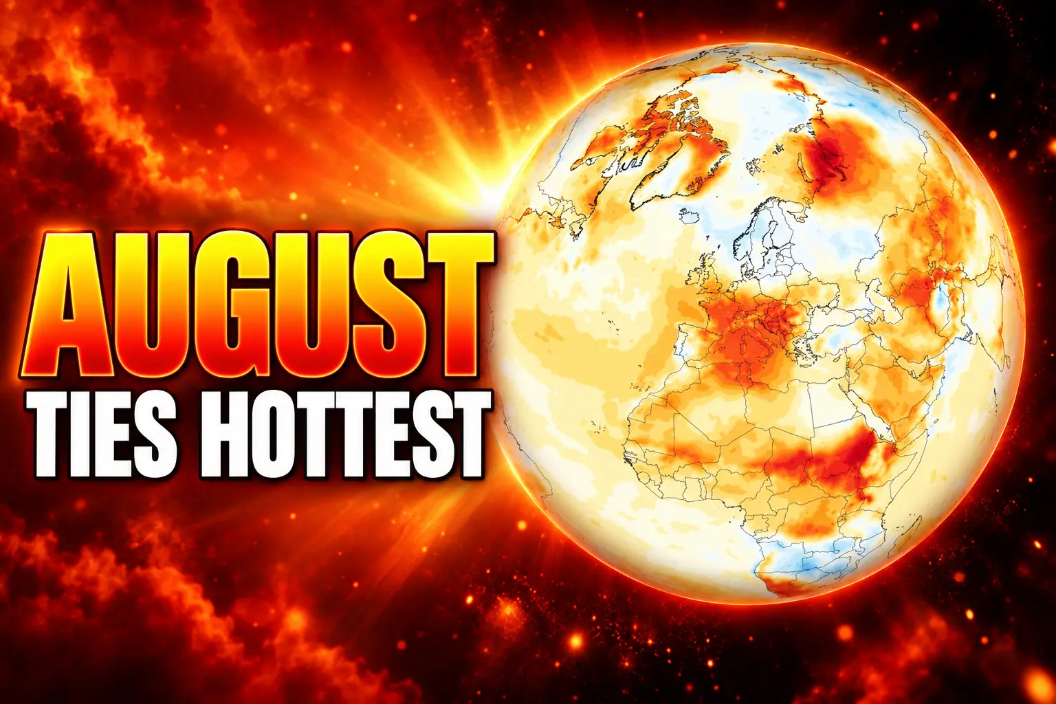
August 2026 averaged 16.96°C (62.53°F) at Earth’s surface, tying July 2023 as the hottest month in the Copernicus ERA5 record. The reading sat 1.65°C above the 1850-1900 average, the first month back above 1.5°C since November 2025.
The twelve-month mean is still 1.48°C above that older baseline. NOAA’s Climate Prediction Center says the El Niño behind the Pacific heat is still strengthening.
A Rare August That Outran Its Own July
The Copernicus Climate Change Service, run by the European Centre for Medium-Range Weather Forecasts, put August 0.85°C above the 1991-2020 mean for the month. That made it the warmest August globally in the ERA5 dataset, 0.14°C above the previous August marks of 16.82°C, shared by 2023 and 2024.
Across every calendar month, August sits on par with July 2023 at 16.95°C. Copernicus puts the gap at less than 0.01°C. The EU service also called August 2026 the joint warmest month ever recorded.
August ran 0.06°C warmer than July 2026. July is usually the hottest month of the year. In ERA5, which starts in 1940, August beat July in the same year only in 1945, 1951, 1955 and 1985.
HOW AUGUST 2026 COMPARES
| Period | Global reading | Against 1991-2020 | Standing |
|---|---|---|---|
| August 2026 | 16.96°C | +0.85°C | Warmest August; joint-hottest month |
| July 2023 | 16.95°C | Not stated for that baseline | Previous joint-hottest month |
| August 2023 and 2024 | 16.82°C | +0.71°C | Previous August records |
| Extra-polar sea surface, August 2026 | 21.07°C | Not stated for that baseline | Joint-highest any month, with March 2024 |
Land ran hot on its own. The global land average for August was 15.73°C, 0.02°C above the August 2024 mark of 15.71°C. From January through August, 2026 ranks as the second-warmest year to date, behind 2024 and ahead of 2023. Copernicus notes that the 2023 El Niño lifted the final four months of that year, so the year-to-date order can still move.
The EU Earth observation account posted the August bulletin on 10 September.
🌡️ August 2026 was the warmest August on record globally.
According to the latest C3S Climate Bulletin, global-avg surface air temp reached 16.96°C – 0.85°C above the 1991–2020 avg
🛰️ The data reveal striking regional differences across Europe.
🔗 https://t.co/DVuUwVqJHa pic.twitter.com/bSjM2joI0N
— Copernicus EU (@CopernicusEU) September 10, 2026
The Twelve-Month Average Is Still 1.48°C
The Paris temperature goal is a long stretch of years, not a single calendar month. From September 2025 through August 2026, the running twelve-month average was 0.60°C above 1991-2020 and 1.48°C above 1850-1900. That window includes a cooler 2025, which pulled the mean back under 1.5°C after 2024 became the first calendar year above that line.
August punched through again at 1.65°C above 1850-1900. It does not, by itself, close the Paris books. It does show how little headroom is left once a Pacific warming event starts to stack on a hotter baseline.
June to August 2026 matched 2024 as the joint-highest boreal summer, at 0.69°C above 1991-2020. Copernicus flags 2023 as the third-warmest of those seasons. The summers of 2024 and 2026 sit well clear of 2025.
If the last four months of 2026 are as warm as the last four months of 2023, Copernicus says the 2026 annual average would sit close to 2024, the current warmest year. Forecasts cited in the same bulletin hold that this El Niño will strengthen further and exceed the 2023 event.
Western Europe Finally Topped the 2003 Summer
Western Europe left the 2003 heat season behind. For the region Copernicus defines from 11°W to 15°E and 37°N to 55°N, June to August averaged 21.69°C, 2.54°C above 1991-2020, the highest seasonal figure in that series. The old record was 2003, long treated as a one-off. Every western European summer since 2015 has been warmer than average, and 2022 had already drawn close to 2003.
ERA5 shows the highest summer since at least 1979 across virtually all of England, Wales and Belgium, and across most of France, Spain, Italy, Switzerland and Austria. National agencies in France, the United Kingdom, Ireland, the Netherlands, Belgium, Spain and Austria reported record-hot summers of their own. Unseasonable warmth ran into early September.
WESTERN EUROPE’S RECORD SUMMER
- Regional mean: 21.69°C for June to August, 2.54°C above 1991-2020.
- Europe as a whole: Third-warmest summer, 1.17°C above 1991-2020, behind 2024 at 1.55°C and 2022 at 1.34°C.
- August on the continent: 20.26°C over European land, 1.10°C above 1991-2020, the fourth-warmest August, and 0.63°C below August 2022.
- Heat belt: France, Italy, Bosnia and Herzegovina, Croatia, Hungary, Romania and much of the Balkans ran about 3°C to 5°C above the August 1991-2020 mean.
Northern Europe was the exception. Iceland, Fennoscandia and the Baltic countries ran slightly cooler than average in August. Visitors at Zakrzówek Lake in Kraków waded through 38°C air on 5 August as the heat reached southern Poland.
NOAA data put the contiguous United States at its warmest meteorological summer in a record that starts in 1895. The Lower 48 averaged 74.4°F from June through August, about 0.4°F above 1936 and 2021. August itself averaged 75.6°F, the hottest in that series. Arizona, Colorado, New Mexico and Utah sat at the top of their summer lists, with Arizona tying its prior high.
A March-Level Ocean Heat in August
Extra-polar seas, the belt from 60°S to 60°N, averaged 21.07°C in August, 0.09°C above the August 2023 record of 20.98°C. That monthly figure also ties March 2024 as the highest extra-polar sea-surface temperature for any month in ERA5. March is the usual annual peak. August is normally a lower, second bump.
Daily values had already been the highest on record for each calendar day since 19 June. On 24 and 25 August they reached 21.11°C, 0.02°C above the March 2024 daily mark of 21.09°C. Copernicus notes that some other sea-surface products do not rank this August as the highest monthly extra-polar reading, because ERA5 estimates temperature at about 10 metres depth.
The equatorial Pacific did much of the lifting. Record August warmth covered large parts of the central and eastern tropical Pacific, with strong to severe marine heatwave conditions spreading since April. European seas ran record-hot for August along the Atlantic coast and in the western Mediterranean, again under marine heatwave flags.
NOAA’s 10 September ENSO discussion, issued as an El Niño Advisory, said sea-surface anomalies exceeded +3.0°C in the eastern equatorial Pacific. August index values reached +1.8°C in Niño-3.4, +2.5°C in Niño-3 and +3.4°C in Niño-1+2, while Niño-4 slipped to +0.1°C. Subsurface anomalies still exceeded +10.0°C at depth. The agency gives a greater than 90% chance of a very strong event in Northern Hemisphere fall and winter 2026-27, and a 75% chance that October-December reaches a three-month Relative Oceanic Niño Index of +2.5°C or more, above every event in its record back to 1950.
Marc Alessi, a climate scientist at the Union of Concerned Scientists, said this El Niño “is occurring on top of a changed climate from the burning of fossil fuels.” He added, “We now live in a completely different climate than the one that existed 50 years ago.”
Why a Monthly 1.65°C Spike Is Not the Paris Breach
A month above 1.5°C is a warning light, not the treaty test. The Paris goal is a multi-decadal global mean, assessed over a long stretch of years rather than any one August. Copernicus is explicit that a single month above the line does not mean the Paris temperature goal has been breached. The twelve-month figure of 1.48°C is still under that line, even as August sat at 1.65°C.
THE PARIS 1.5°C LIMIT
- What it measures: Long-term global warming against 1850-1900, not one month or one year.
- Where 2024 sits: The first calendar year whose average exceeded 1.5°C, according to the United Nations Environment Programme.
- Where 2026 sits now: The latest twelve-month window is 1.48°C; August 2026 is a monthly spike of 1.65°C.
- What still moves the mean: A very strong El Niño through early 2027 can lift the trailing average back through 1.5°C and hold it there.
Samantha Burgess, ECMWF’s strategic lead for climate, tied the month to impacts already on the ground.
August 2026 was a remarkable month in the global climate record. It was both the warmest August and the warmest month ever recorded, with global temperatures reaching 1.65°C above pre-industrial levels, marking the return of global temperatures above 1.5°C. Combined with record global sea surface temperatures and the warmest summer on record for Western Europe, these observations show how climate change is driving extremes across both the atmosphere and the oceans. The impacts of these conditions are increasingly being felt by communities, economies and ecosystems across the world.
Samantha Burgess, Strategic Lead for Climate, ECMWF
Record-Low Flows on the Rhine and Danube
Heat was only half the European season. Copernicus mapped drier-than-average soils across western Europe and large parts of the centre and east, with the worst August rainfall shortfall in the east and southeast. Surface soils stayed exceptionally dry even where August rain eased a little, a hangover from May onward. France, the United Kingdom, Hungary, Romania and Serbia reported severe drought. Wildfire activity followed the dry belt.
The Copernicus EU account said fires affected more than 1.2 million hectares across Europe and North Africa this summer, including 19 fires larger than 10,000 hectares between 1 July and 31 August. Indonesia posted its highest August fire emissions in the Copernicus Atmosphere Monitoring Service series since at least 2003, lifting Asia’s monthly fire total. Those fires sit on the same dry, hot pattern that has already forced a carbon recount from AI wildfire detection satellites in other basins.
River flow is where the season’s heat turns into a logistics problem. Irrigation intakes, barge grain and cooling water all draw from the same channels, so a low river hits farms and freight together.
RIVERS AT EXCEPTIONAL LOWS
- August extremes: The Rhine, Danube, Southern Bug and Dnieper ran at exceptionally low flows.
- Brief recovery: The Vistula, Glomma, Rhône, Seine and Po also reached exceptionally low levels before late-August rain lifted them a little.
- Seasonal records since 1992: Large stretches of the Seine, Rhône, Loire and Glomma recorded their lowest June-August flows in that series.
- Full-length lows: Record-low seasonal conditions ran the entire Danube, Vistula and Rhine.
Wetter pockets still flooded. Western Iberia, the Alps, northeastern Europe and eastern Türkiye saw heavy rain. Outside Europe, August was drier than average across much of the southern United States and northern Mexico, parts of Canada, the Maghreb, the Horn of Africa, Siberia, central Asia, China, South America, South Africa and northern Australia.
UNEP Now Maps a Path Down From Overshoot
Eight days before the August bulletin, UNEP published Limiting Overshoot. The report says that under current policies and near-term paths, exceedance of 1.5°C is now widely assessed as unavoidable. If governments deliver every climate pledge and net-zero target, UNEP still projects a peak of about 1.8°C. The report’s remaining route is overshoot, peak and decline: go through 1.5°C, keep the peak as low and as short as possible, then bring the mean back down.
Mirey Atallah, chief of UNEP’s Adaptation and Resilience Branch and coordinator of the report, put the shift in one line.
Decisions, science and, most importantly, mindsets need to shift to seeing 1.5°C as a goal we’ll be approaching from above rather than below.
Mirey Atallah, Chief, Adaptation and Resilience Branch, UNEP
UNEP’s explainer is blunt about the cost of that path. Going beyond 1.5°C raises the odds of Amazon dieback, permafrost thaw and ice-sheet collapse. It also leans harder on carbon dioxide removal, including novel systems that can cost up to $600 per tonne. Global food production, the same note says, could decline 14 per cent by 2050. Falling temperatures later would not restore the old climate, because oceans, ice and ecosystems lag by decades. That is the case for approaching from above rather than below.
THE PATH BACK ABOVE 1.5°C
- November 2025: Last month before August 2026 with a global mean more than 1.5°C above 1850-1900.
- 2 September 2026: UNEP issues Limiting Overshoot and treats 1.5°C exceedance as unavoidable.
- 10 September 2026: Copernicus publishes the August bulletin; NOAA raises the historic-El-Niño odds to 75 per cent for October-December.
- 8 October 2026: Next scheduled ENSO diagnostic discussion from NOAA’s Climate Prediction Center.
Arctic sea ice in August ranked 12th lowest for the month. Antarctic ice ranked fourth lowest. Those ranks are not the story of the month. The air and the extra-polar ocean are.
The next CPC discussion lands on 8 October. Until then the Pacific event is still building, and August has already matched the hottest month anyone has measured.
Frequently Asked Questions
Does one month above 1.5°C mean the Paris Agreement limit is breached?
No. Article 2 of the Paris Agreement aims to keep long-term warming well below 2°C and to pursue 1.5°C, judged on a multi-decadal global average rather than a single month. Copernicus and UNEP both treat a monthly spike as distinct from that test, even when the month itself sits at 1.65°C.
What is the ERA5 dataset behind the August 2026 record?
ERA5 is ECMWF’s global reanalysis, combining observations and a weather model to estimate conditions back to 1940. The surface air figures are two-metre temperatures over land and ocean. The sea-surface figures are foundation temperatures at about 10 metres, which is why some other ocean products do not match the extra-polar ranking.
What does extra-polar ocean mean in the Copernicus bulletin?
It is the ice-free ocean between 60°S and 60°N. Copernicus uses that belt so seasonal sea ice at the poles does not distort the average. August’s 21.07°C mean and the 21.11°C daily peaks both refer to that domain, not the entire world ocean.
Why is an August hotter than July so uncommon?
The Northern Hemisphere holds most of the planet’s land, and land heats fastest in July. Ocean heat peaks later, so a global August that beats its own July usually needs unusual ocean warmth. ERA5 has only four earlier cases, in 1945, 1951, 1955 and 1985, which is why the 0.06°C gap in 2026 stands out.

Hurricane Nolo Hits a Big Island Still Digging Out

Gaza Families Remain in Buildings Already Cleared to Fall

Sony Polls Publishers Who Cannot Press PlayStation Discs Elsewhere

UN Settlement List Hits 214 as Investors Take Notice

Fuel Pushes UK Inflation to 3.1% With Core Unchanged

Thameslink Will Pad 60,000 Ironing-Board Seats From 2027

Micron Sells the Memory Shortage as Five-Year Contracts

Royal Caribbean Sends Los Angeles Ships to Singapore and Brisbane

Burger King Rebuilds Chicken Nuggets After Calling Them Rubbery

U.S. Forces Clear Hormuz Mines, Then Hit Minelayers Again
-
 NEWS1 month ago
Thameslink Will Pad 60,000 Ironing-Board Seats From 2027
-
 NEWS1 month ago
Micron Sells the Memory Shortage as Five-Year Contracts
-
 NEWS1 month ago
Royal Caribbean Sends Los Angeles Ships to Singapore and Brisbane
-
 BUSINESS1 month ago
Burger King Rebuilds Chicken Nuggets After Calling Them Rubbery
-
 BUSINESS1 month ago
U.S. Forces Clear Hormuz Mines, Then Hit Minelayers Again
-

 NEWS1 month ago
Twenty Controllers Closed Norwich Airport for a Bank Holiday
-

 BUSINESS1 month ago
Sweetmore Bakeries Buys Fantasy Baking for Bar Work
-

 NEWS1 month ago
Frontier Miles Cuts Basic Fares After the Barclays Pact