
NEWS
AI Wildfire Detection Satellites Force a Carbon Recount
OroraTech and FireSat now see 5-by-5-meter ignitions, a jump that will keep lifting global fire-carbon counts built on 500-meter pixels.

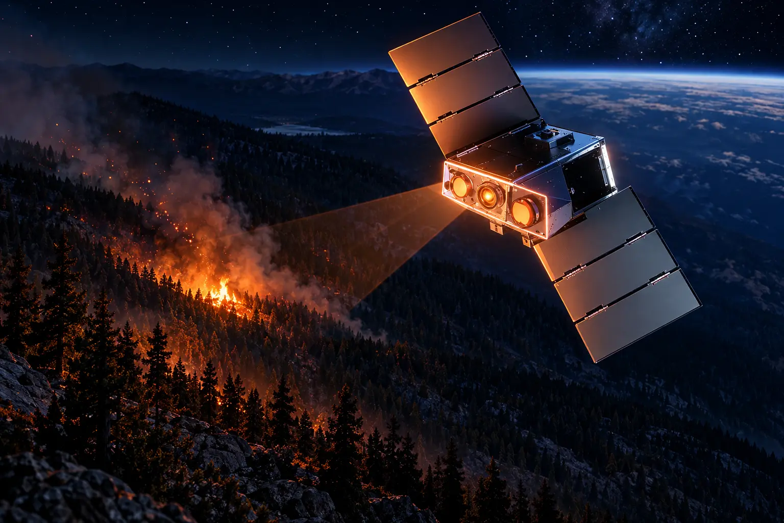
OroraTech’s OTC-P1 satellites flagged the Rock Fire at 4:37 p.m. PT on July 20, 2026, in a California camera blind spot. The Munich company said the alert landed six hours before any public satellite. Cal Fire lists the start at 4:50 p.m. near Poverty Hills, on Black Rock Springs Road and Highway 395 east of Kings Canyon.
The operational win is a first ping on a fire that ground cameras never saw. The longer shift is that sensors in this class are built to count burns that 500-meter fire maps left out, which is how global fire-carbon books keep moving.
The Rock Fire Started in a Camera Blind Spot
Inyo National Forest held jurisdiction. Cause remains under investigation. Evacuation orders and warnings came off on August 3, 2026, the same day Cal Fire’s 12,008-acre Rock Fire incident log showed containment at 98 percent.
OroraTech said no ground camera had a view of the ignition, and that for the first two hours its network was the only source of a fire perimeter crews could use. The company posted its own clip of that pass.
The Rock Fire (California) ignited in a blind spot no ground camera could reach.
Our OTC-P1 constellation caught it anyway, at 4:37 PM PT, six hours before any public satellite picked it up.#Californiafires #Wildfireseason pic.twitter.com/NGUhYR5YtO
— OroraTech (@OroraTech) July 28, 2026
OTC-P1 is not a one-off cubesat. Rocket Lab’s Electron lofted eight of the buses on March 27, 2025, from Māhia, New Zealand, into a 550-kilometer sun-synchronous orbit. OroraTech said the plane was fully operational on April 23, 2025. Its public site now lists 14 of its own satellites in low Earth orbit and a feed fused from 35-plus public and private sources.
THE ROCK FIRE CLOCK
- March 14, 2025: Earth Fire Alliance’s FireSat protoflight reaches orbit on a SpaceX Transporter-13 rideshare.
- March 27, 2025: Eight OroraTech OTC-P1 satellites deploy from Electron.
- April 23, 2025: OroraTech calls OTC-P1 operational and opens a Denver office.
- July 7, 2026: Three operational FireSats launch from Vandenberg on Transporter-17.
- July 20, 2026: OTC-P1 records a Rock Fire hot spot at 4:37 p.m. PT.
- August 3, 2026: Cal Fire lists 12,008 acres and 98 percent containment; evacuations drop.
- September 3, 2026: Bridger Aerospace says OroraTech’s thermal feed is going into its IGNIS software.
Dima Rashkovetsky, OroraTech’s team lead for data engineering, has told customers that a detection after an hour is borderline useless for first responders. The Rock Fire ping was built against that clock, not against a science mosaic that lands the next morning.
The Pixel Size That Hid a Generation of Burns
Fire detection from orbit is older than the startups now selling it. In 1980, Jeff Dozier and Michael Matson, working at NOAA, spotted gas flares from Middle Eastern oil wells as tiny bright spots on NOAA-6. Dozier published a method in 1981 for finding high-temperature areas in radiometer data. Most classical fire algorithms still sit on that idea.
When vegetation burns, it throws extra energy in the mid-wave infrared. The pixel that holds the flame shows a jump in brightness temperature. Early detectors used a fixed cutoff. Contextual algorithms followed, raising or lowering the cutoff from local background, then subtracting known industrial hot spots such as flares and steel plants.
NASA used those lessons on MODIS and on the Visible Infrared Imaging Radiometer Suite, which fly in low Earth orbit and typically pass a given place a few times a day. NOAA’s GOES satellites stare continuously at coarser resolution. For decades that mix was the global fire record. It is also why a cooking-scale ignition, or a field burn that never fills a 500-meter cell, could vanish from the books.
Michael Falkowski is Earth Fire Alliance’s lead scientist, after running NASA’s Wildland Fire Program. He has said that from space, for decades, the world was really blind to where small fires are, and that burned area and fire carbon are probably drastically underestimated as a result.
Small Fires Added 1.4 Gigatonnes to the Books
That blindness is no longer a hunch. The fifth Global Fire Emissions Database, published in Scientific Data on November 28, 2025, puts global landscape-fire carbon at 3.4 gigatonnes a year on average for 2002 to 2022. Inventories that used 500-meter MODIS burned area had sat near 2.0 gigatonnes for years, a figure that fed the Global Carbon Project and IPCC assessments. The gap is 1.4 gigatonnes, about 70 percent.
Our estimates of emissions have never changed so dramatically as they have now. Although our data have been refined over the years, our estimate of annual emissions was always around 2.0 gigatonnes of carbon, or about 20% of fossil fuel emissions. Now it is almost 70% higher, around 3.4 gigatonnes.
Guido van der Werf, Professor of Landscape Fires and Carbon Cycle, Wageningen University & Research
The GFED5 global fire emissions dataset does not claim the extra carbon is mostly Sierra Nevada crown fire. van der Werf’s group found forest-fire totals were not much higher than before, because those burns were already large enough for older sensors. The new fire is elsewhere.
HOW THE CARBON COUNT MOVED
| Record | Period | Global fire carbon | What the sensors missed |
|---|---|---|---|
| GFED4-era baseline | Multi-year MODIS era | About 2.0 Gt C per year | Burns smaller than a 500-meter cell |
| GFED5 | 2002 to 2022 | 3.4 Gt C per year | Small fires, new fuel maps, new emission factors |
| Burned area, high-resolution mix | 2001 to 2020 | About 770 million hectares per year | 93 percent above the MODIS MCD64A1 map |
| Global cropland burned area | 2003 to 2020 | 81 million hectares per year | 32 million hectares in MCD64A1 |
Sentinel-2 at 20 meters roughly doubled MODIS burned area across Africa. Savannas in Africa and Australia still account for about 70 percent of fire carbon in the new ledger, with deforestation fires in South America and Asia near 10 percent and boreal North America and Siberia near 10 percent. The extra detections cluster in places with more people, which is an air-quality problem as much as a carbon one.
A 5-meter active-fire sensor is not required to finish that revision. GFED5 already used finer burned-area maps. What it cannot do is watch an ignition grow, measure fire radiative power on a 20-minute beat, and hand the same file to a crew and a carbon lab. That is the product the new fleets are selling.
What a 5-by-5-Meter Hot Spot Changes
Earth Fire Alliance is a nonprofit. Muon Space builds the spacecraft. Google.org, the Bezos Earth Fund, and the Gordon and Betty Moore Foundation sit among the backers. Three operational FireSats reached orbit on July 7, 2026, from Vandenberg Space Force Base on SpaceX’s Transporter-17 mission, after a protoflight in March 2025 had already flagged small, cool burns that older satellites missed.
Sundar Pichai, Google’s chief executive, wrote the next morning that the first FireSat had, in a year on orbit, spotted wildfires invisible to existing satellites, and that three more had just joined. CAL FIRE, a partner, described the long-term aim as seeing a fire as small as two parking spots. EFA’s own spec sheet is the 5-by-5-meter minimum fire detection on an 80-meter average image, with a 1,500-kilometer swath and six imaging channels across five bands.
The alliance interviewed more than 200 firefighters, incident commanders, and scientists before freezing that design. It states a false-positive target under 5 percent and 99 percent coverage of Earth’s wildfires once the full 50-plus satellite fleet is up. Revisit is the slow part. Three satellites give a twice-daily pass over fire-prone regions after checkout. EFA’s next published target is a one-hour global revisit by 2029, then 20 minutes or less in the early 2030s.
SENSOR CLASS COMPARED
| System | What it resolves | How often it looks | Who flies it |
|---|---|---|---|
| MODIS / VIIRS class | About 500-meter fire pixels | A few LEO passes per day | NASA and NOAA heritage |
| GOES | Coarser, continuous disk | Stares all day | NOAA geostationary |
| OTC-P1 | Dedicated thermal IR, onboard alerts | Afternoon and night gap-fill; 30-minute goal at full build | OroraTech, 8 launched in 2025 |
| FireSat | 80-meter image, 5-by-5-meter hot spot | Twice daily now; 1 hour in 2029; 20 minutes in the 2030s | Earth Fire Alliance / Muon Space |
Google Research helped shape the instrument and the software. On its FireSat page the lab says models will compare each scene with a thousand prior images of the same spot, then fold in weather and nearby infrastructure before calling a fire. EFA also lists four products that fire managers asked for.
FIRESAT DATA PRODUCTS
- Hotspot ID: Near-real-time flags on new or growing ignitions, including small, low-intensity starts.
- Fire perimeter: A shared outline of the outer edge for resource calls and crew safety.
- Progression: Direction, speed, and spread for command and evacuation planning.
- Fire radiative power: Energy released, used to judge behavior, ecosystem damage, and carbon.
That last product is the science hook. If FRP lands at 5-meter scale on a 20-minute clock, the next GFED-style update will not be waiting on a 20-meter reflectance mosaic after the black is cold. EFA’s U.S. illustration for a one-hour revisit, labeled as a projection, is $1 billion in avoided damage, 3,500 homes, 1.3 million acres, and 21.9 million tons of carbon kept out of the air.
The Detection Model Fits on a Jetson in Orbit
Speed dies if the image has to hit the ground before anyone looks at it. OroraTech runs detection on the satellite, on Nvidia Jetson Xavier NX modules, and downlinks the essential alert before the full frame. Rashkovetsky has said the company is talking about minutes. It trained with supervised learning on hand-labeled fires, and it started by protecting precision: if the model called a fire, it was supposed to be a fire, even if that meant missing some of the small ones. Later passes pulled more of those small events back in without blowing the onboard memory budget.
Classical threshold codes struggle to swallow weather, site history, and the way a steel plant looks at 4 p.m. AI makes that extra context cheaper to add, which cuts sun-glint and stack-emission false alarms. It does not remove uncertainty. Agencies do not share one cost for a miss.
HOW A DETECTION EARNS A SCORE
- Model confidence: The onboard classifier’s own probability that the pixel is fire.
- Fire weather: Indices that say whether the air and fuel can carry a start.
- Vegetation: Fuel maps that separate a barren roof from a grass slope.
- Persistence: Whether the same hot spot is still there on the next look.
Users learn the score and filter alerts to match staff. Some shops would rather chase ghosts than lose a start. Others cannot roll an engine for every low-confidence ping. Rashkovetsky treats the score’s recipe as the trust layer, because remote sensing already asks people to act on a scene they cannot walk.
Trust is a major issue in everything remote sensing related, but specifically also with AI. People are rightfully not willing to make a decision based on just a black box.
Dima Rashkovetsky, Team Lead for Data Engineering, OroraTech
The same constraint shows up in California’s own FireSat notes. CAL FIRE has said satellite data will sit beside aircraft, cameras, drones, maps, and crew reports, and that the hook into its systems still has to be reviewed. A 5-meter detection that never leaves a PDF is a press release, not a dispatch.
Bridger Puts Satellite Heat on the Fireline
On September 3, 2026, Bridger Aerospace said it would integrate satellite detections into the IGNIS platform that government crews already use. Sam Davis, Bridger’s president and chief executive, said the point is to put intelligence in the hands of crews and incident commanders before aircraft even reach the fire. Thomas Grübler, OroraTech’s U.S. chief executive, called it closing the gap between space, air, and the fireline. Bridger says the hook is already in the field.
We've partnered with @OroraTech to change wildfire response.
OroraTech is a leader in space-based thermal intelligence, running one of the world's only satellite constellations built specifically to detect and monitor wildfires. Now, that technology is fed directly into IGNIS,… pic.twitter.com/SbFZxS66YS
— Bridger Aerospace (@BridgerAero) September 4, 2026
That is the pattern in the quieter corners of this build. OroraTech has a five-year thermal feed into SOPFEU in Québec, covering 52 million hectares. It has sold into Idaho and into a Canadian national early-warning contract. Exolaunch says OroraTech booked FOREST-20 onto SpaceX’s Transporter-18 mission, targeted no earlier than October 2026. EFA, meanwhile, is still checking out the July trio. Operational FireSat data is due to early-adopter agencies and scientists in the fourth quarter of 2026, at least twice a day, with wider science and commercial access through 2027 and 2028 and global access anticipated by 2028.
None of those dates puts a 20-minute worldwide stare on a chief’s desk this fire year. They do put a dedicated thermal pass over places that used to wait for a MODIS overpass, a lookout, or a 911 call. The Rock Fire was the loud example because it started where cameras were not pointed. The quieter use is the same class of fire GFED5 just dragged into the carbon ledger: small, often near people, easy to miss in a 500-meter cell, and numerous enough to move a gigatonne.
Falkowski has said the system should improve fire operations and global fire science at the same time. The science half is already in motion without waiting for 50 satellites. The operations half now depends on whether a confidence score, sitting inside software a crew already trusts, is enough to roll an engine toward a pixel that no one on the ground has seen.

Kering’s Growing Houses Cannot Outrun a Shrinking Gucci

Studio Staff and Bitcoin Buyers Built the Eminem Leak Case

A Mutated H1N1 Strain Is Hitting Younger Immunity First

Albert Heijn Returns at One-Third as Rivals Take Share

Art Basel Paris Ends After One Public Day

Thameslink Will Pad 60,000 Ironing-Board Seats From 2027

How Tall Was Adolf Hitler Really? Debunking the Myth of his Height

Micron Sells the Memory Shortage as Five-Year Contracts

Royal Caribbean Sends Los Angeles Ships to Singapore and Brisbane

U.S. Forces Clear Hormuz Mines, Then Hit Minelayers Again
-
 NEWS2 months ago
Thameslink Will Pad 60,000 Ironing-Board Seats From 2027
-
 SCIENCE3 years ago
How Tall Was Adolf Hitler Really? Debunking the Myth of his Height
-
 NEWS2 months ago
Micron Sells the Memory Shortage as Five-Year Contracts
-
 NEWS2 months ago
Royal Caribbean Sends Los Angeles Ships to Singapore and Brisbane
-
 BUSINESS2 months ago
U.S. Forces Clear Hormuz Mines, Then Hit Minelayers Again
-

 BUSINESS2 months ago
Sweetmore Bakeries Buys Fantasy Baking for Bar Work
-

 BUSINESS2 months ago
L Catterton Installs a Kraft Heinz Operator at Kettle Cuisine
-

 NEWS2 months ago
CISA’s 100 Water System Hacks Hit One-Operator Plants