
NEWS
Nolo Targets Slopes That Lala Already Soaked
Polo is back at 180 mph off Mexico, while Nolo aims 15 to 30 inches of rain at Big Island slopes still wet from Lala.

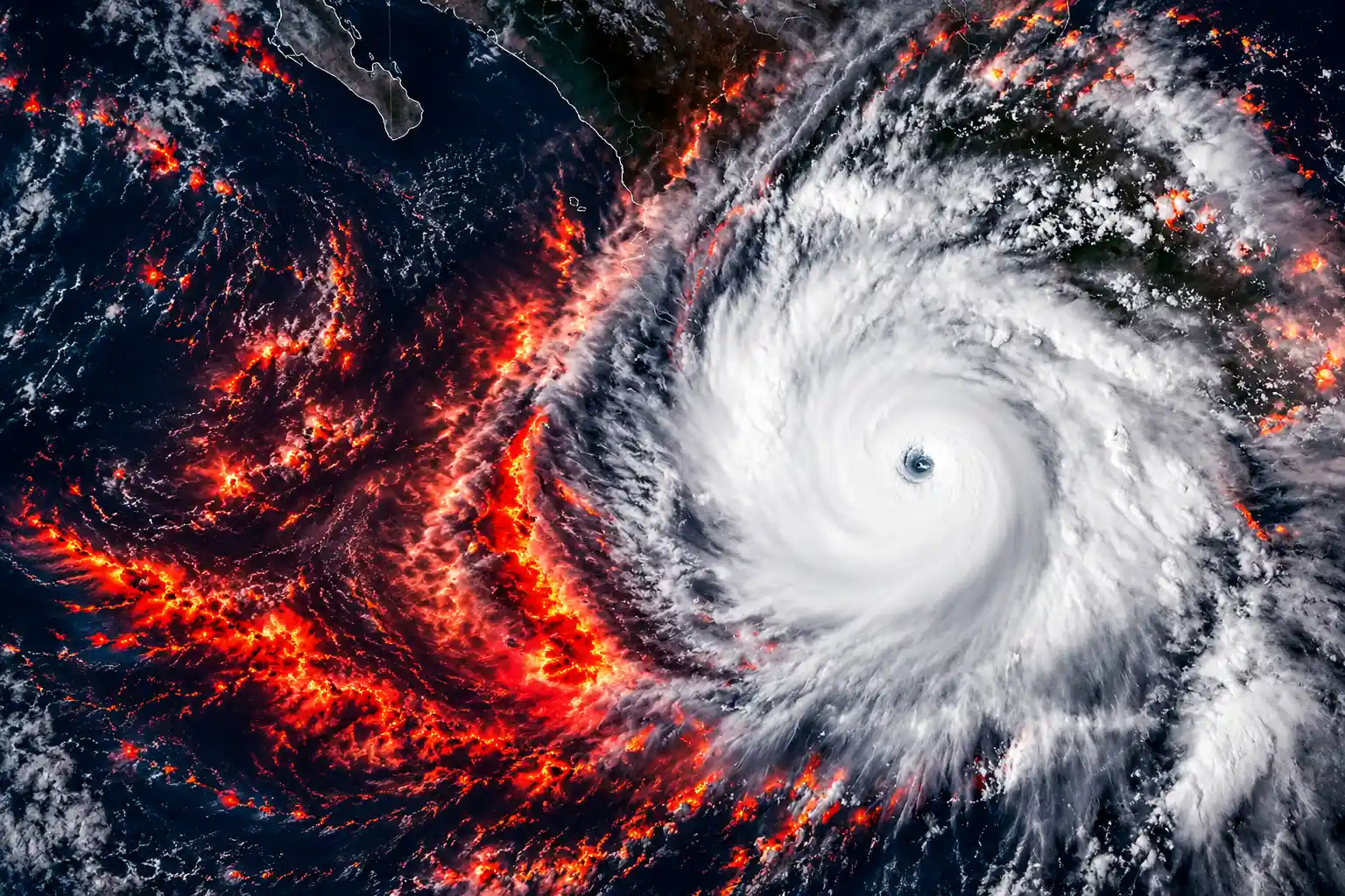
Hurricane Polo was estimated at 180 mph Friday morning, a Category 5 again, while Hurricane Nolo aimed 15 to 30 inches of rain at Hawaii’s Big Island. The National Hurricane Center placed Polo about 280 miles southwest of Cabo Corrientes at 5:50 a.m. MST on September 25, with a central pressure of 908 millibars. Nolo was a hurricane with 85 mph winds, 220 miles south of South Point, drifting north-northeast.
The land problem is the stack. Nolo’s heaviest rain is aimed at the same eastern and southern Big Island slopes Hurricane Lala drowned in August, and Polo is forecast to hook toward Baja California Sur after already driving surf through Michoacán.
Rain on the Same Big Island Slopes
Nolo’s center is still expected to stay south of the main islands, but the rain does not need a landfall. The Central Pacific Hurricane Center, in a 2 a.m. HST intermediate advisory on September 25, warned of catastrophic, life-threatening flash flooding on the Big Island into the weekend. Eastern and southern slopes were given rainfall totals of 15 to 30 inches, with local amounts of 35 inches. Western parts of the island were forecast to see 5 to 8 inches, locally 10. Maui was put at 4 to 8 inches, locally 15. The rest of the chain was 1 to 3 inches, locally 6.
A Hurricane Watch and a Tropical Storm Warning covered Hawaii County. A Tropical Storm Watch covered Maui County. Tropical storm conditions were expected on the Big Island by Friday night, with hurricane conditions possible Saturday in steep terrain as Nolo is forecast to become a major hurricane. Hurricane-force winds reached 40 miles from the center. Tropical-storm-force winds reached 105 miles. Storm surge of 1 to 3 feet was possible in Hawaii County, with damaging surf on east- and south-facing shores.
Stephen Parker, a meteorologist at the Weather Service office in Honolulu, said the islands’ lava rock and soil are porous, but recent rain means the ground will not take much more to saturate. That is the second hit. Lala’s eyewall passed near South Point around 4 p.m. HST on August 15 as a Category 1 hurricane, the first direct hurricane strike on the Big Island since an unnamed storm in 1871.
RAIN ON THE BIG ISLAND, STORM BY STORM
| Area | Lala in August | Nolo forecast |
|---|---|---|
| Hāmākua, Hilo, Puna, and Kaʻū | 15 to 30 inches, locally more than 3 feet | 15 to 30 inches, locally 35 inches |
| Western Big Island | Lighter than the windward slopes | 5 to 8 inches, locally 10 inches |
| Maui | Flooding on windward and eastern slopes | 4 to 8 inches, locally 15 inches |
The Honolulu Weather Service’s August summary put 15 to 30 inches across the Hāmākua, Hilo, Puna, and Kaʻū districts during Lala, with the highest totals exceeding 3 feet in parts of southeastern Kaʻū and around Laupāhoehoe. Most of that rain fell in about 15 hours. Roads washed out. Communities were cut off. Those are the same districts now under Nolo’s 15 to 30 inch forecast.
Governor Josh Green closed state and county offices, public schools, and University of Hawaiʻi sites on Hawaiʻi Island on September 24 and 25, and extended those closures to Maui County on September 25. He asked for a federal emergency declaration covering all four counties. The Department of Land and Natural Resources shut state parks, trails, forest reserves, and camping on Hawaiʻi Island starting September 24, and on Maui and Molokaʻi starting September 25. Hawaiian Electric said crews that had been restoring power on Kauai after Hurricane Lowell would return to Oahu, Maui, and the Big Island.
How Close Will Polo Come to Baja California Sur?
The Hurricane Center has high confidence Polo will make landfall in Baja California Sur and then mainland Mexico after crossing the Gulf of California, still near major hurricane strength as it approaches. There were no Mexican coastal watches in the 2 a.m. MST package on September 25, because the eye was moving west, farther off western Mexico. Swells were still expected to pound southwestern shores and spread toward Baja through the weekend. Forecaster Andrew Hagen wrote that a mid-latitude trough should turn Polo north and then northeast around a ridge over northern Mexico.
POLO ON FRIDAY MORNING
- Winds: 180 mph estimated at 5:50 a.m. MST September 25, with a 908 millibar center about 280 miles southwest of Cabo Corrientes.
- Earlier peak: 180 mph and 892 millibars on September 22, when Hurricane Hunters sampled the eye.
- Track: west at 12 mph on Friday, with a turn northwest Saturday, north Sunday, and northeast early the following week.
- Inland moisture: leftover tropical air from Polo and Odalys may add to flash-flood risk in the southwestern United States over the weekend and early the next week.
Polo formed as a tropical depression on September 20 and was a tropical storm the next day. By September 22 it was a Category 5. NOAA’s National Centers for Environmental Information, in a preliminary IBTrACS review posted by NESDIS, ranked Polo’s wind jump of 95 knots in 24 hours as the third fastest in the eastern Pacific, behind Hurricane Patricia in 2015 (105 knots) and Hurricane Otis in 2023 (100 knots). The same review found an 88 millibar pressure drop in 24 hours, second only to Patricia’s drop of about 100 millibars. The Hurricane Center called that burst “truly remarkable.”
This was RAPID, rapid intensification.
Gary Partyka, atmospheric scientist, NASA Goddard Space Flight Center
NASA Earth Observatory, using Aqua MODIS and the MUR sea-surface temperature project, showed Polo moving over water as warm as 32 degrees Celsius (90 degrees Fahrenheit) on September 23, 2 to 3 degrees warmer than usual for that date. Much of the region sat above 27.8 degrees Celsius (82 degrees Fahrenheit), the rough threshold that can keep a hurricane going. Kristen Corbosiero, an atmospheric scientist at the State University of New York at Albany, pointed to a large clear eye, strong outflow, and high ocean heat content at depth, which limited the usual cool wake. Partyka and Corbosiero both warned against pinning that one burst on El Niño alone. Otis and Patricia also exploded in other phases of the cycle. What El Niño does change is the count: NASA noted that eastern Pacific accumulated cyclone energy was nearly twice the Colorado State University norm as of September 24.
Mud Still Covers Streets in Lázaro Cárdenas
Before the eye pulled west, Polo had already used the Mexican coast as a surf machine. In Lázaro Cárdenas, a Michoacán port, seawater ran through homes on September 24 and left wooden planks and furniture in the streets. Locals and officials cleared wrecked ramadas and shoveled mud. Alicia Contreras said 15-foot (4.5-meter) waves tore up the walls and roof of her restaurant.
This is huge because we have no other source of income. Now we’re just surviving.
Alicia Contreras, restaurant owner, Lázaro Cárdenas
Mexican authorities opened shelters, pulled people off beaches, and evacuated high-risk zones without giving a public headcount. They deployed 15,000 security personnel along the coast and suspended schools. The heaviest worry sat in Guerrero and Michoacán, neighboring states whose shoreline is a string of small ports, tourist towns, and fishing villages. Residents there often say they are left to handle disasters themselves.
Memory is doing part of the work. Hurricane Otis in 2023 flattened much of Acapulco with little warning, and Polo’s own strengthening rate now sits just behind Otis and Patricia in the eastern Pacific record book. Gonzalo Ramírez, a bartender in Acapulco, put the mood in one line after Otis: “So many people said it wouldn’t happen and then it did. After that, you’re left on edge.” Polo’s core is farther offshore than Otis was. The swells, the mud, and a forecast strike on Baja are still a live bill.
Three Category 5 Hurricanes Before October
Polo is the third Category 5 hurricane of the 2026 Pacific season, following Genevieve and Lowell, which reached Category 5 after moving into the Central Pacific, according to NESDIS. Matthew Rosencrans, NOAA’s lead hurricane season forecaster, said the eastern and central Pacific were already four named storms above the 1991-2020 pace, with more than two months left in a season that runs through November 30. NOAA’s May outlook had called for 15 to 22 named storms, 9 to 14 hurricanes, and 5 to 9 major hurricanes in a strong El Niño year.
THE THREE CATEGORY 5S
- Genevieve: The season’s first Category 5, counted by NESDIS with Lowell and Polo.
- Lowell: Hit Category 5 after crossing into the Central Pacific, then brushed Kauai in early September, the first hurricane impact on Kauai County since Iniki in 1992.
- Polo: Reached Category 5 on September 22, eased during eyewall cycles, and was estimated at 180 mph again on September 25.
Hurricane Odalys was still being advised far west-southwest of Baja, well out to sea. In the Atlantic, Tropical Storm Fay was hundreds of miles from the Azores and Tropical Storm Gonzalo was near the Cabo Verde islands. El Niño years often cut Atlantic activity and feed the Pacific. Both basins still had names spinning on September 25. Another low south of the Gulf of Tehuantepec had a 40 percent chance of becoming a depression within 48 hours and a 90 percent chance within seven days, forecast to crawl west-northwest along southern Mexico. A second low was expected about 1,000 miles east-southeast of Hawaii.
Why Hawaii Has Three Hurricane Watches in 2026
John Bravender, warning coordination meteorologist at the National Weather Service in Honolulu, said he has not seen three hurricane watches for the islands in the same year in two decades on the job. Lala, Lowell, and Nolo are that set. Hawaii had already taken major spring flooding and an earthquake before the first of those storms. Nolo’s rain is now pointed at the same southeastern Big Island belt Bravender flagged as still wet, with isolated communities and washed-out roads from August.
THE THREE WATCHES
- August 15, 2026: Lala’s eyewall passes near South Point as a Category 1 hurricane, dumping 15 to 30 inches on windward Big Island districts and more than 3 feet in spots of Kaʻū and Laupāhoehoe.
- Early September 2026: Lowell forces hurricane warnings for Kauai County, knocks out Kauai’s weather radar, and sends Hawaiian Electric crews west; Green’s first September cyclone proclamation pre-positions Guard units and high-water vehicles.
- September 24-25, 2026: Nolo becomes a hurricane, a Hurricane Watch goes up for Hawaii County, and Green’s third proclamation, covering Lowell and Nolo through November 21, keeps the Guard on call, with more than 230 members activated.
Bravender’s line is the season in miniature. “In my 20 years of experience here, I’ve never seen three hurricane watches for the islands in the same year,” he said. The watches are not three separate scares on dry ground. They are the same islands taking rain, surf, and wind before the last round of repairs is done. Nolo does not have to cross the coastline to add another 15 to 30 inches to slopes that already proved they can fail.
Moisture From Polo and Odalys Heads Inland
Polo’s Friday Category 5 reading is a satellite story until the track bends. Hagen’s discussion still showed major-hurricane intensity as the cyclone nears Baja, then a rapid fade once it crosses the peninsula and the mainland under higher shear. Interests in Baja California Sur were told to watch the updates and keep a plan ready. Along southwest Mexico, the leftover threat is life-threatening surf, rip currents, and coastal flooding from swells that do not care that the watches have been dropped.
STILL ON THE MAP
- Polo: Category 5 well off Mexico, forecast to recurve toward Baja California Sur early the next week.
- Nolo: Hurricane south of the Big Island, major-hurricane strength possible Saturday, heaviest rain on already wet windward slopes.
- Odalys: A hurricane far from land, its moisture sharing the inland pipeline toward the U.S. Southwest.
- Next name: A low south of Tehuantepec with a 90 percent chance of becoming a depression by early the following week.
On the Big Island, the clock Bravender and Parker described is already running. Heavy rain was forecast to increase in coverage and intensity through Friday, then keep coming through the weekend. Polo, 2,000-odd miles to the east, still had enough warm water and a clear eye on Friday morning to hold 180 mph while it waited for the turn that aims it at Baja.

Kering’s Growing Houses Cannot Outrun a Shrinking Gucci

Studio Staff and Bitcoin Buyers Built the Eminem Leak Case

A Mutated H1N1 Strain Is Hitting Younger Immunity First

Albert Heijn Returns at One-Third as Rivals Take Share

Art Basel Paris Ends After One Public Day

Thameslink Will Pad 60,000 Ironing-Board Seats From 2027

How Tall Was Adolf Hitler Really? Debunking the Myth of his Height

Micron Sells the Memory Shortage as Five-Year Contracts

Royal Caribbean Sends Los Angeles Ships to Singapore and Brisbane

U.S. Forces Clear Hormuz Mines, Then Hit Minelayers Again
-
 NEWS2 months ago
Thameslink Will Pad 60,000 Ironing-Board Seats From 2027
-
 SCIENCE3 years ago
How Tall Was Adolf Hitler Really? Debunking the Myth of his Height
-
 NEWS2 months ago
Micron Sells the Memory Shortage as Five-Year Contracts
-
 NEWS2 months ago
Royal Caribbean Sends Los Angeles Ships to Singapore and Brisbane
-
 BUSINESS2 months ago
U.S. Forces Clear Hormuz Mines, Then Hit Minelayers Again
-

 BUSINESS2 months ago
Sweetmore Bakeries Buys Fantasy Baking for Bar Work
-

 BUSINESS2 months ago
L Catterton Installs a Kraft Heinz Operator at Kettle Cuisine
-

 NEWS2 months ago
CISA’s 100 Water System Hacks Hit One-Operator Plants